

|
|
On Saturday 21st July 2007 I decided to take my dog for a walk through the countryside outside Maghera N. Ireland. Ever since my recent Funnel cloud sighting with Conor McDonald on Tuesday July 17th I have become fascinated with funnel clouds. I seen twin funnels (Sisters) below a storm on the previous day. However, since the 'big one' I have been watching the sky ever since for more. My daily five mile walks were just another excuse to go funnel hunting. It was very hot here and I could see good growing cumulus congestus updraughts in the N where the sky was dark underneath. I was amazed to see a suspicious form protruding from the cloud deck. As I watched I was both shocked and amazed to see this living form gently descend from the cloud base, and lower while slowly bending to become a brilliant white funnel. It was very close to me and formed into a white comet-like shape followed by a sharp spearhead or parabolic form. I could see its white snout rotating with the naked eye which was incredible. It lasted from 14.49-14.54 BST for a duration of five minutes. It was an incredible sight and needless to say I got plenty of images to share with you. This is my fourth Funnel in four days. What a spectacular Summer this has been!. Here are a small selection of the 40 images I took of the funnel at various stages...
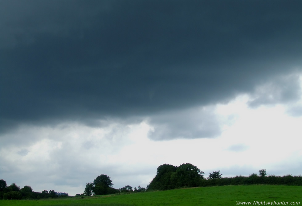 |
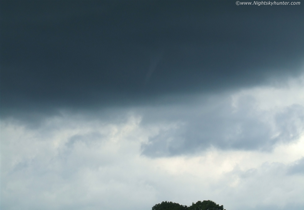
Looking N and upwards at the dark base of the large updraught tower which showed good wind shear. You can see the white funnel lowering out from the central region. Note the striations on the cloud base indicating that the cloud itself was rotating. The cloud base was dark, funnel white, and the background sky was lit in a severe way by the intense high level afternoon sun hence why the image is overexposed. This is a 32mm capture, the widest setting on my 32-200mm zoom lens.
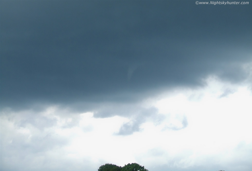 |
It was a high-based updraught so getting the funnel and foreground within the frame was a difficult thing to do. Well defined shape now. This was much more impressive looking with the naked eye. Even now as I write this I can vividly recall the mad rotation like a spinning top, as well as the silence in the country which was broken occasionally by the periodic calls of the Buzzards circling high on their own updraughts. The sun was burning the back of my neck and generated glare on the LCD screen making the task of photography very difficult.
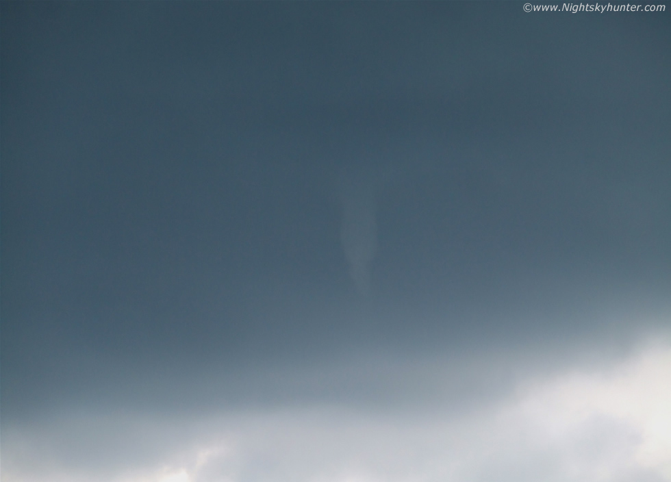 |
There was great rotation in this. A zoom shot obviously. Funnel is swelling at centre. It lowered, spinned, went back up, then lowered again while changing shape from a vertical tuba to a curved finger which reminded me of a Shark's tooth without the serrated edge.
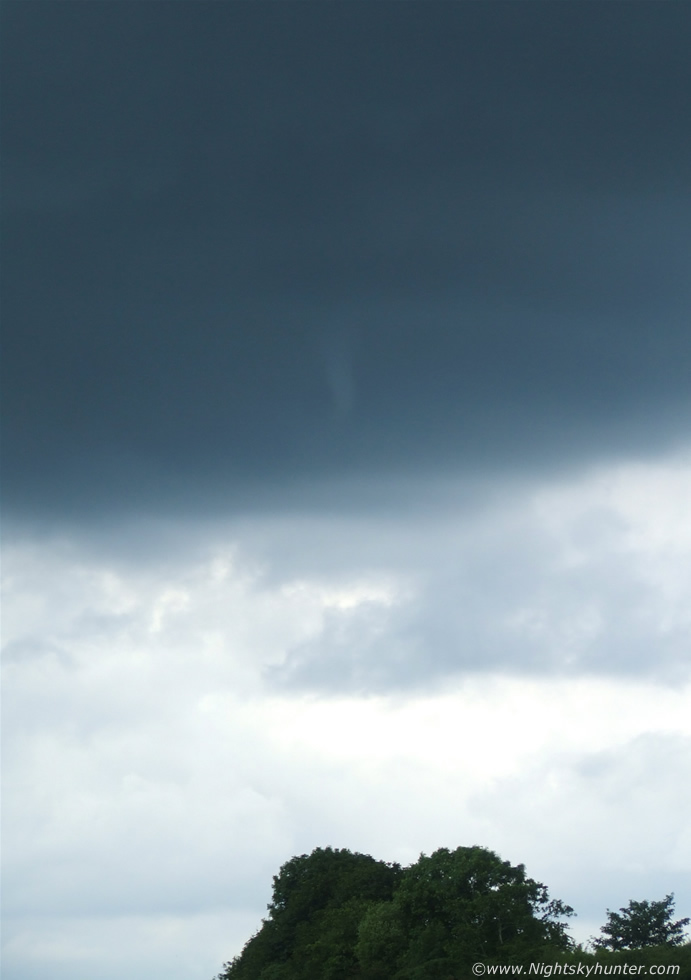 |
Vertical capture over the trees. Pity it didn't lower further and disturb those tree tops. I was standing there daring it to lower onto the ground. I was saying out loud...''come on, come on, get lower, get lower''.
 |
Final shot of the many I took. Funnel is slender then in slow motion it rose back up into the cloud base and vanished for good. The sighting was short but sweet, since it was unexpected I was delighted. As a matter of fact there was no convective forecast out today so this was the last thing I was expecting. The strong heat combined with a local convergence zone caused this funnel to form. It certainly made my day anyway.
I also took some quick video footage using my digital camera but at this stage the funnel was a sorry sight as it weakened and ascended back into the cloud, although you can still see it as a white, thin, dangling 'worm'.
Cold-air (or cold-core) funnel clouds are usually short-lived and generally much weaker than the vortices produced by supercells. Although cold-air funnels rarely make ground contact, they may touch down briefly and become weak tornadoes or waterspouts. Unlike the related phenomenon associated with severe thunderstorms, cold-air funnels are generally associated with partly cloudy skies in the wake of cold fronts, where atmospheric instability and moisture is sufficient to support towering cumulus clouds but not precipitation. The mixing of cooler air in the lower troposphere with air flowing in a different direction in the middle troposphere causes the rotation on a horizontal axis, which, when deflected vertically by atmospheric conditions, can become a funnel cloud.
Martin McKenna